


Interactive maps of urban developments in Amsterdam
Development of interactive maps to communicate the city planning developments to the public.
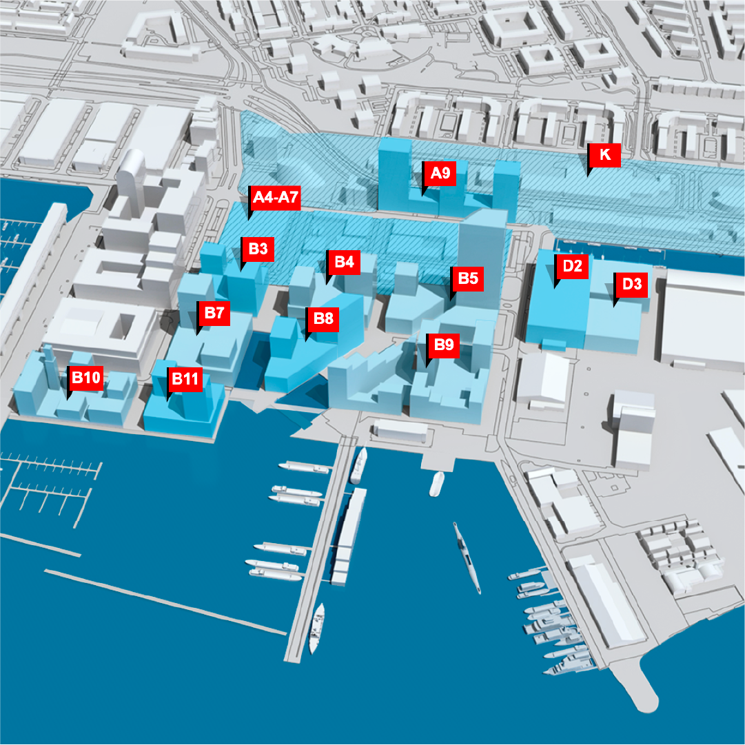
Examples of the interactive maps
Houthaven
Buiksloterham
NDSM-werf
Overhoeks
Overamstel
Sloterdijk Centrum
Arenapoort
Waterlandpleinbuurt
Klaprozenbuurt
Banne Noord
Elzenhagen Zuid
Buikslotermeerplein
Project Information
Client
Amsterdam Grond & Ontwikkeling
Type
Interaction Design
Design team
Willie van Burgsteden
in cooperation with Robert Heit (Amsterdam Beeld & Data) and the Amsterdam web project team
Technical realisation
Ronald Werring, Ypos
hart-van-noordherderfactory-brand-identitybasetide-recruitment-communicationtravel-hamburginteractive-maps-of-urban-developments-in-amsterdamiconic-houses-brand-identityiconic-houses-bookiconic-houses-at-riskiconic-houses-conferencesbuiksloterham-en-coid-signature-websitebook-parisvova-wervingurban-signature-online-magazinetoeristic-folders-amsterdambook-brooklynfolder-stationsgebied-en-oosterdokeilandhistor-kleurkompasbook-valenciatimmeren-aan-het-hamerkwartierparticipatie-duurzaamheid-amsterdam-noordwerkplek-te-huur-aan-het-water-hartje-amsterdamw-brand-identityb-catalogs-b-brand-identitybook-cote-d-azurbook-creative-processesnomu-boba-matcha-coffeeconceptbooks-studioninedotsfabulous-notebookswerkplek